Sunday, December 28, 2008

December 26-27 review

The severe weather event was pretty remarkable late on Dec 26th and into Dec 27th. Early Christmas Eve brought a couple inches of snow to the northern third of MO, with overnight lows on Christmas Day of 0°F-15°F. By the next afternoon, record highs were broken over many of the same areas, with temperatures pushing 70°F near the edge of the retreating snow pack. Moreover, the airmass over the Gulf of Mexico had plenty of time to modify during the previous week, and unseasonably rich moisture was ushered northward to eastern KS and MO as well.

I had the day off on the 26th and left at 430P.M. with a rough target of Chanute KS. Initiation probably wouldn't occur until after 9 P.M. as a strong 700mb thermal ridge was cresting over the western edge of the moist axis during the afternoon and early evening. Still, very strong cold advection in the 800-500mb layer was forecast to overspread ridiculous boundary layer moisture--ML dewpoints around 15°C in eastern KS and western MO--resulting in strong low-level destabilization overnight regardless of diurnal cooling.

In the end, I was caught generally on the southwest edge of where storms initiated--which at first seemed to be on the northern fringe of the richest boundary layer moisture oriented SW-NE, though storms gradually formed farther south as well. Still, I was able to catch up with a well-developed cell moving from Iola to Paola between 10 and 11 P.M., right about the time it received a severe thunderstorm warning. Shockingly, the overcast stratus that had accompanied the moisture surge had broken up several hours prior (before sunset)... and even with the ramping up LLJ, redevelopment of stratus had remained very patchy. Thus I had a great look of the storm, particularly as the lights from south metro KC illuminated it a bit (lightning activity was semi-limited). The structure was quite nice, compact and decidedly low-precipitation, with a flanking line trailing to the southwest. At cloud base it looked a little messier and possibly OFD, though a lowering/wall cloud was present on the leading edge of the rain free base. Wasn't able to document the storm very well even with video given the storm speed... not long after it raced away from me thru the metro, moving at about 60mph.

Below is a modified NAM sounding and composite profiler hodograph to represent the storm. Note the unseasonably moist boundary layer and strong low-level bouyancy, which was verified by the 06Z Lamont OK sounding, However, with northward extent, 500-1000m flow veered a good bit during the evening... and given the storm was not rightward-deviant, low-level shear wasn't as strong as I'd have liked to seen for a tornado threat given the strong environmental wind fields and total CAPE AOB 1000 J/kg. So I think shear was just a bit too straight-line/unidirectional to allow the storms to do much, though I also wonder if a more well-defined source for significant vertical motion wouldn't have helped the storms fare better. Convection seemed to become more organized and increasingly supercellular later on toward northeast MO and west central IL (STL even cranked out some tornado warnings), where hodographs remained far more curved all night long and storms tried to turn to the right of the mean wind... though low-level static stability was probably increasing near the effective warm front, which was also farther removed from the richest BL moisture. Hodographs similarly remained more curved all night farther south into far southeast KS and northcentral/northeast OK... I'm not sure how to account for the lack of activity there, though I haven't reviewed that part of the event super closely as of yet.

As strong synoptic scale lift and strengthening jet dynamics began to interact with very strong low-level frontogenetical forcing that accompanied the synoptic cold front, a few bow echoes developed and raced through the KS-MO border region between 08-12Z, causing isolated damage and up to 80mph wind gusts. If the more favorable synoptic lift had not been lagging the warm sector, I think a tornado outbreak would have likely occurred over eastern KS, eastern OK, and MO that night.


Wednesday, November 12, 2008

Nov 10 review

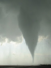
A substantial-looking "cold core" tornado occurred northwest of Johnson, KS Monday afternoon, documented by Mike Umscheid of WFO DDC. The pattern fit those studied by Jon Davies pretty well... with the tornadic mini-supercell occurring to the cool side of a baroclinic boundary, and in the northeast quad of an incoming vort max (though in this case the low wasn't really closed off) beneath cold temps aloft (-3C and -23C at 700 mb and 500 mb respectively in this case!). Jon has an excellent summary of this fascinating event on his blog.

I've completed a modified sounding, shown below, mainly in order to illustrate the role of elevated terrain
(which I believe to have been considerable) in this case. Despite semi-borderline-low dewpoints for a cold core event (upper 40s F)... as well as very modest surface heating amidst localized cloud breaks to the cool side of the boundary (low 50s immediately ahead of the surface low)... this sounding still cranks out relatively ridiculous levels of instability! MLCAPE of over 700 J/kg and 0-3 km MLCAPE of 120 J/kg is mighty impressive considering the meager low-level theta-e... and that is strongly attributed to the elevation in far southwest KS (near 3300 ft MSL). If a surface parcel is lifted (which Jon Davies recommends for monitoring cold core tornado events IIRC), the instability numbers are even more outrageous!

As impressive as the conditions were in far southwestern KS, they became unfavorable for strongly surface-based convection pretty quickly as one moved eastward to gradually lower terrain (e.g. toward Garden City). Heating to the cool side of the boundary was negligible farther east with a lack of breaks in the dense stratus. Regardless, even if areas there had cleared and heated similarly into the lower 50s, the capping inversion (sampled by the 00Z DDC RAOB) still may not have broken due to modest low-level theta-e and lower elevations. In hindsight, it's not surprising that convection with the upper level low was pretty much tied to the most elevated terrain farther west, while cells to the east struggled to break the cap... though it should be noted that a plume of elevated instability was in fact present well to the east, based above the surface stable layer (per DDC RAOB).

The modified sounding that follows is from the NAM, which was all that was available to me in NSHARP (the best sounding software on the planet) by the time I got to work today; turns out this would work okay to modify since the pressure surface of the sounding--875 mb--was appropriate for Johnson, KS based on the relative elevations and observed pressure surfaces at AMA and DDC. The NAM sounding itself looked pretty crummy, and I substituted a blend of the 00Z DDC and AMA RAOBs alongside a couple online RUC soundings I'd saved from GSD... with minor modifications to the boundary layer based on Mike's observations during his chase. The result should be quite close to reality.


I haven't messed with constructing a hodograph for this case yet...may do that later. The DDC RAOB indicated fairly impressive 0-1 km SRH of 175 m2/s2 for cells moving N at ~15 kts, but the low-level hodograph there is probably a little too large to be representative. Cold core tornadoes in close proximity to surface lows usually have fairly modest low-level shear, but this case may've been an exception with 0-1 km SRH probably AOA 100 m2/s2.

Monday, November 10, 2008

Nov 10 fcst udpate

This is a relatively brief forecast update. The 00Z NAM last night brought some new concerns to the mix, and 12Z observations and new model guidance this morning continues to show a somewhat tricky severe weather forecast.

The dryline play is looking less impressive. The main axis of the mid-level wave has been forecast to slow down considerably, as evident in this morning's water vapor imagery... and will scarcely help at all with respect to surface-based initiation this afternoon. Instead, an impulse embedded in the base of the trough, crossing far northern Sonora/Chihuahua attm, is more likely to be a player as it ejects toward northwestern TX near peak heating. The 12Z DRT RAOB indicated 100mb ML dewpoints of 63F+ which will easily be drawn northward ahead of the length of the dryline... and with fairly strong heating still expected in at least a narrow corridor, 1000-1500 J/kg MLCAPE remains likely. However, initiation may be fairly localized due to the far more modest nature of the synoptic scale forcing for ascent... and in turn, a weaker dryline circulation. Another concern is that the last couple runs of the NAM-WRF support the GFS trends of fully re-developing the 40-kt LLJ eastward toward the I-35 corridor... considerably reducing low-level shear. Accordingly, the best bet for tornadoes off the dryline may be with storms crossing the surface warm front, which may be near the couple rows of TX counties south of the red river. Hodographs here will be modestly enlarged due to backed surface flow.. however, with mid-level flow of ~60kts, storms may outrun any favorably surface-based environment fairly quickly.

If sufficient cloud breaks occur, moderately strong instability may shape up across the Texas Hill country today well in advance of the dryline as rich moisture influx (ML dewpoints of 64-68F) occurs from deep south Texas. Any storms that manage to form here would have an enhanced tornado threat as they approach I-35 in the Waco to Austin corridor. Short-term models are pretty inconsistent with regard to how much heating and destabilization will occur here, and a mechanism for achieving lift and convective initiation in this area seems nebulous as well... so the forecast there is similarly tricky, at least from what I've looked at thus far this morning.

Sunday, November 9, 2008

Nov 10 fcst for North TX

The potential for a tornado event across portions of north Texas on Monday is increasing based on the latest model guidance.

The ECMWF has been very consistent the past several days in its handling of a seasonably potent shortwave trough that is currently moving onshore from the Pacific... forecasting amplification through the southern Rockies and into the southern plains, and mass response/backed low-level flow contributing to large hodographs and deep moisture for potentially significant surface-based severe storms late on Monday. Meanwhile, the GFS has ben rather inconsistent from run-to-run, and generally has forecast the ejection of a more progressive and positive-tilt upper system--less favorable for tornadoes.

The jet energy on the back side of the trough is nearly fully onshore this morning and thus sampled in part by the northern CA RAOBs... and the 12Z NAM-WRF model is in very close agreement to the solution offered by the ECMWF the past several days. As a result, my forecast will closely follow the high-res NAM-WRF guidance. The 12Z GFS has suddenly trended in the direction of the ECMWF and NAM, but remains a little less potent with regard to tornado potential. Accordingly, this evening's obs and guidance will be monitored closely for last-minute trends.

Water vapor imagery attm shows the strong upper trough digging toward the lower CO river valley, with a downstream 500 mb 12-hr height fall center of 200 m attesting to the strength of this feature. Modified gulf moisture, with surface dewpoints of 63-65F, is already returning over deep south Texas and adjacent portions of Mexico as pressures fall in the lee of the Rockies. This moisture is favorably deep, with a nearly 2 km deep moist layer sampled on the ADN RAOB (west of BRO)!

Vertical motion associated with a significant lead impulse will enhance isentropic lift and moisture transport atop a stable near-surface layer late tonight, resulting in showers and thunderstorms across the eastern TX panhandle, northwestern TX, and western OK through the mid-morning hours. The majority of this convection may end up staying primarily north of the ultimate target area for surface-based storms later on Monday.

In the wake of this convection, a favorably timed and subsident mid-level dryslot will overspread the eastern TX south plains and adjacent northwestern TX by early afternoon. Downward transfer of westerly momentum will gradually sharpen the dryline as it mixes to near a Childress to Sweetwater line during the afternoon. A couple of discrete supercells should initiate and develop on or ahead of the dryline by 4-5 PM as significant ascent with the primary shortwave trough rotates across the area.

Ahead of the dryline, dewpoints of 60-64F should materialize in the wake of the warm front via northward advection and downward mixing. With strong heating expected in at least a narrow corridor, MLCAPE of 1000-2000 J/kg is expected in the warm sector. Low-level thermodynamics are forecast to be quite favorable for tornadoes, with modest T/Td spreads (low LCLs) and "cool" thermal profiles above the boundary layer (strong low-level CAPE). Meanwhile, mid-and high-level flow will certainly support significant supercells, and hopefully will not be too strong so as to overwhelm updrafts amidst moderate instability. Low-level hodographs should recover/enlarge slightly through afternoon as 30-40 kt 1 km flow backs to SSW in response to dynamic support, contributing to 0-1 km SRH of 200-300 m2/s2. The net result should be an appreciable localized tornado threat over northwestern TX ~5-9 PM, particularly if and where the warm sector is broad enough to allow storms to develop significant low-level mesocyclones before becoming elevated north/east of the surface warm front. Farther south, a tornado threat may actually persist through the night as very rich moisture influx (surface dewpoints of 65-68) helps to maintain weak inhibition well after dark.


Saturday, November 8, 2008

starting up a blog

I'm developing this blog mainly as a means of putting down my forecast thoughts in advance of severe weather events in the Plains and Midwest... especially for set-ups that I watch "from home" due to working operational shifts rather than chasing. My primary focus will likely be on set-ups with supercell and tornado potential. November is a heck of a time to be starting a blog like this, and accordingly there may not be a great deal of posting during the upcoming winter months.